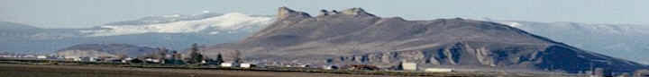
Several Upper Basin irrigators shared concerns with
Klamath County Commissioners on Wednesday about the
approximate 50 percent loss in cattle revenue in the
region, a dive that irrigators link to a call on water
by the Klamath Tribes, validated by Oregon Water
Resources Department.
The Klamath Tribes, which have a senior water right,
made the call on March 8. Oregon Water Resources
Department (OWRD), using water gauges in the Wood River
to monitor flows, validated the request in April.
Some of the concerns shared by irrigators include no
stockwater delivery for Modoc Point irrigators.
“Historically Modoc Point has never been cut off (from)
water,” said Linda Long, a longtime irrigator in Modoc
Point. “To drive by there and see everything brown and
no water or cattle or anything,” Long added, “it breaks
your heart.”
The group of irrigators came to the commission meeting
on request from Commissioner Donnie Boyd, who initially
spoke with fifth-generation rancher Randall Kizer in the
Wood River Valley regarding water in the region.
Boyd wanted Kizer and others to update the commission on
the status of water in areas in the Upper Basin,
including between Beatty and Bly.
“It’s insane what’s going on,” Kizer told commissioners.
“This crisis was created by the state of Oregon, and
it’s been going on for the last 15 or 20 years.”
Kizer served as president of the former Landowner’s
Entity, which dissolved as result of the end of the
Upper Klamath Basin Comprehensive Agreement (UKBCA). The
UKBCA, which terminated in December, addressed needs of
water users in the upper basin not affiliated with the
Bureau of Reclamation’s Klamath Project.
Kizer believes OWRD has given too much water to the
Tribes.
“They just went out and just basically gave the Tribes
all the water without basically giving consideration to
anybody else,” Kizer said. “We have asked for them to
remand this back, now that we have more data. We do have
gauges that are measuring the amounts of water, although
we’re still struggling with getting those measurements
right.
“We’d been keeping our water until 2013,” Kizer added,
noting that was the first year of water shutoffs to the
area.
Prior to 2013, when OWRD started regulating water, Kizer
said he believes the Wood River was pristine, and the
economy thrived.
“We had a healthy cattle economy,” Kizer said.
“Production was the same as it had been for over 100
years.”
Now, Kizer said the cattle industry is down at least 50
percent of what it used to be.
“(For) the first time in 146 years that we have had this
piece of property, our riparian area is in jeopardy,”
Kizer said.
Boyd expressed concerns with the gauges utilized by OWRD
on the Wood River, one guage monitors flows for the U.S.
Geological Survey (USGS) and another for OWRD personnel.
Boyd believes the two conflict.
“The gauge isn’t in a place that they’re capturing 100
percent of the water,” Boyd said. “The water’s either
going into a diversion that is leaking or it’s spilling
into the Crooked Creek. So OWRD’s not capturing 100
percent of the water going down the Wood River.”
“They don’t read the same,” Boyd added. “They don’t
interpret the data the same.”
Ivan Gall, administrator for OWRD’s field services
division, in a phone interview told the Herald and News,
that OWRD is evaluating the water gauge locations.
“We have implemented additional measurements at those
locations with our staff, and we’ve been working in
close coordination with the U.S. Geological Survey on a
number of occasions, to do what we call side-by-side
measurements,” Gall said.
Gall said OWRD and USGS personnel compare measurements
from the same location, and then split up into teams and
go out and measure throughout the Wood River system to
make sure the gauges are accurate.
“Our gauges are measuring accurately at the location
that they’re sited,” Gall said. “I think the landowners
are concerned that they may not be sited at the right
spot, and we are continuing to evaluate that the best we
can, to find out if there are better locations that
would meet the criteria within the determined claims.”
Commissioners expressed concern for irrigators in the
Upper Basin, though no commission action was taken at
the meeting.
“I
think we need to start figuring out ways to help the
Upper Basin people, the Williamson River watershed, or
the Sprague River watershed, and the Wood River
watershed, how we can make sure that they’re getting
their fair share of the water of what has been allocated
to the Tribes, and what’s been allocated to them,” Boyd
said.